
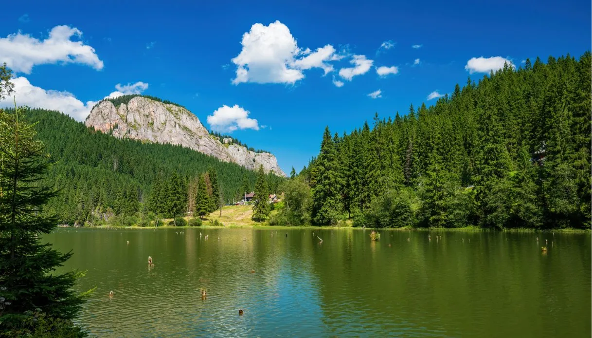
Trees trunks emerge from the dark, still water, some still remarkably upright, others leaning towards the sky. They look like the remains of a petrified forest, yet beneath the surface there’s a far more recent story. We are at the Lacul Roșu, and before the lake itself, here everything was once occupied by a forest. Then the mountain fractured, a colossal mass of debris blocked the watercourse, and the basin slowly filled in.
The result is an almost surreal landscape, tucked away in the Eastern Carpathians, at the foot of the Hășmaș massif, at an altitude of about 983 meters. The lake sits in Harghita County, in eastern Transylvania, not far from the famous Bicaz Gorges. The area belongs to the Cheile Bicazului-Hășmaș National Park, a protected realm characterized by forests, limestone cliffs, deep gorges and peaks surpassing 1,500 meters.
The name can be misleading. The water of Lacul Roșu does not look red at all: the hues shift with the light and can take on greenish, yellowish or brownish tints. The name derives from the Pârâul Roșu, the stream that crosses soils rich in iron oxides and hydroxides, carrying rusty sediments into the basin.
Origin, formation and legends
The birth of Lacul Roșu dates back to the 19th century. According to local sources, 1837 would mark its formation, while other reconstructions link the landslide to the powerful earthquake of January 23, 1838, estimated at magnitude around 6.9. Territorial records thus point to a slightly different chronology, but the geological mechanism is clear: a massive movement of the slope of the Ghilcoș mountain blocked the Bicaz valley and rapidly reshaped the landscape.
Water began to accumulate behind this natural dam, submerging the vegetation on the valley floor. The trees remained rooted to the ground and the trunks continued to emerge from the surface. Nearly two centuries later they still constitute the most recognizable feature of the place.
The surrounding area is mainly composed of limestone rocks, responsible for many of the spectacular shapes of the landscape. The same geological nature reaches its dramatic apex in the nearby Bicaz Gorges, cut by the action of water through imposing rock faces. Then comes the legend, able to render an already impressive geological tale even more dramatic.
The best-known version tells of Estera, a beautiful young woman in love with a man who had gone to military service. In his absence, a highwayman allegedly abducted her and dragged her into the mountains. Estera would have invoked the help of nature, and a fierce storm would have caused the rock to collapse, burying the protagonists and the valley’s forest.
Another tradition instead speaks of a shepherd swept away along with his flock. From these tales arose the idea of a lake colored by the blood of the victims.
The visit to the lake, among boats, trails and limestone gorges
Once there, the visit can begin directly from the shore. The tourist area is developed around the water’s surface, with accommodations, restaurants and small shops. By moving away from the most crowded zones you’ll find a much more intimate atmosphere, especially along the peripheral stretches of the basin.
The quickest way to grasp it all is to follow its perimeter. The Red Lake Circuit, marked with a red cross, takes about 1 hour and 30 minutes. The perspective changes continuously and allows you to observe the trunks from different distances, with the mountains forming a natural backdrop.
A boat trip adds another dimension to the visit: from the center of the basin the trunks appear even more numerous and the valley’s peculiar configuration becomes evident. The water can look very different over the same day, especially when clouds and sun alter the reflection of the mountains.
Bathing is discouraged and generally forbidden, especially because of the submerged trunks. Therefore, a boat remains the most suitable way to experience the lake from the water. Those arriving with hiking boots and a desire to climb can choose among several mountain routes.
Suhardul Mic
The path to Suhardul Mic takes about 2–3 hours round trip and climbs nearly 370 meters in elevation. The route, marked with a blue triangle, leads to one of the best panoramic viewpoints over the lake.
Ucigașu Peak
More demanding is the trek toward the Vârful Ucigașu: about 3 hours total with 401 meters of elevation gain. The trail markers are a yellow band and a red triangle. The summit keeps in its name the memory of the lake’s ancient designation, linked to the Hungarian word gyilkos, meaning killer.
Bicazului Gorges
A few kilometers from the lake, the Bicaz Gorge completely changes the scenery. The DN12C road enters a narrow valley framed by enormous limestone cliffs. In places the rock seems to loom over the roadway, creating one of Romania’s most scenographic road sections.
Among the best-known segments is the Gâtul Iadului, the “Devil’s Throat,” a name perfectly suited to describe the gorge’s particularly narrow stretch. The visit can be done by car with several stops along the route, while the more seasoned travelers can devote more time to the trails in the surrounding mountains.
Where Lacul Roșu is located and how to get there
Lacul Roșu is located in Harghita County, in the eastern part of Transylvania (Romania), within the Eastern Carpathians. The town is about 26 kilometers from Gheorgheni and about 10 kilometers from Bicaz-Chei, in Neamț County. The main link is DN12C, the national road connecting Gheorgheni to Bicaz.
Coming from Transylvania, the route gradually traverses forests and mountain valleys until reaching the lake’s basin. From Romanian Moldavia, the journey passes through the Bicaz Gorges before reaching Lacul Roșu.
Lacul Roșu, among other things, can be visited in any season, but with very different characteristics. Summer offers generally cooler temperatures than the plains towns and favorable conditions for hikes and boat trips. Autumn transforms the surrounding forests with intense hues, while winter brings snow, ice and a decidedly wilder dimension to the landscape. In this latter period, it’s important to pay particular attention to road and trail conditions.
