
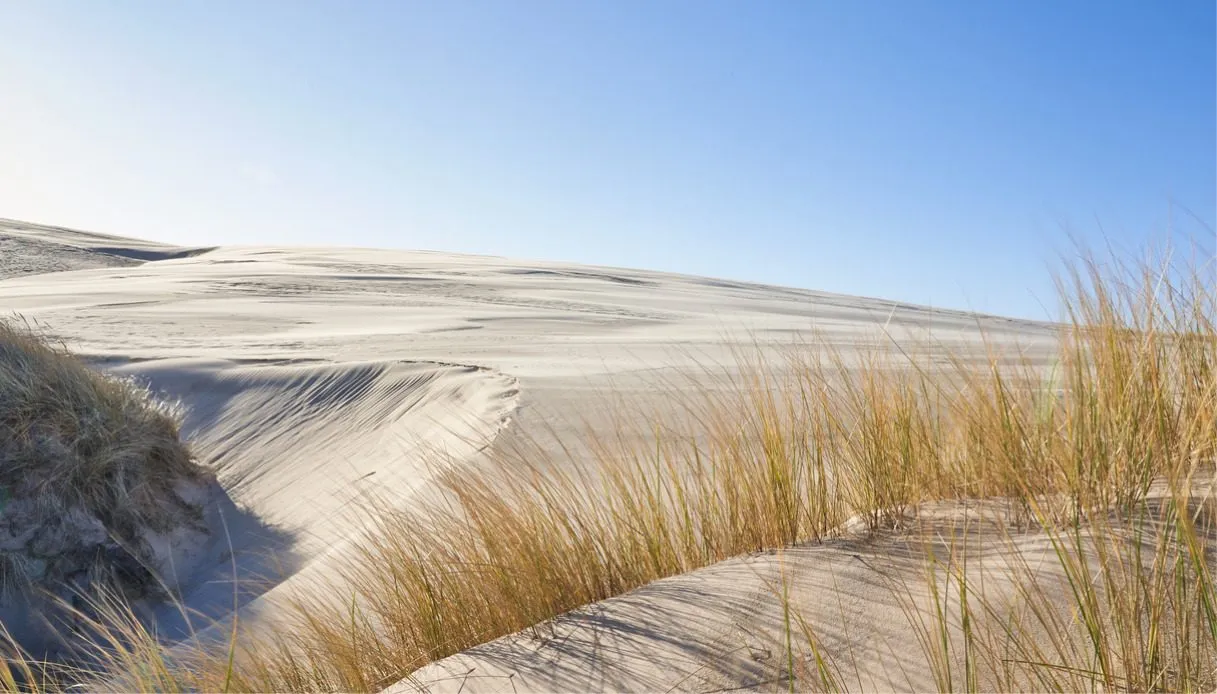
The sand is incredibly pale (almost white) and it settles into dunes with smooth, rolling curves, while the wind seems intent on redesigning the landscape. On the horizon there are green patches that interrupt a cream-colored expanse and, for a moment, make you doubt you’re in Scandinavia. But yes, we are in Denmark, at the far north of Jutland, facing one of the most unusual natural spectacles in all of Northern Europe.
It is called Råbjerg Mile and it is the largest moving dune in the country, a place that evokes a small Sahara relocated to the chilly latitudes of the Baltic Sea and the North Sea. The even more curious fact, however, is that Råbjerg Mile moves by about 15 meters per year, carried by winds that predominantly blow from the west.
Its mass currently reaches around 4 million m³ of sand and its summit rises to 40 meters above sea level. Impressive dimensions for a formation that continues to shift slowly, swallowing vegetation and leaving behind, in its wake, landscapes completely transformed.
Origin and formation of Råbjerg Mile
Over 300 years ago, sand was one of the most serious problems for the inhabitants of northern Jutland: excessive deforestation combined with intensive grazing destroyed the fragile coastal vegetation that kept the grains in place along the shore. Then, between the 16th and 17th centuries, the phenomenon of sand drift reached particularly destructive proportions.
The “credit” for this also went to storms and westerly winds that carried enormous quantities of grains from the coast of the Skagerrak inland, burying farmland, roads and farms. And, precisely because of this, entire communities were forced to abandon their homes, now surrounded by land increasingly difficult to cultivate.
Then came the so-called Little Ice Age, a period in which lower temperatures and a sea level a little lower than today favored broader beaches exposed to the action of the winds. And there man intervened by exploiting the vegetation, further aggravating the situation and leaving vast sandy surfaces unprotected.
It was precisely in this context, in the area called Råbjerg Stene, that the enormous accumulation destined to become Råbjerg Mile took shape. Geologically, it is a parabolic dune, thus characterized by a structure that, seen from above, resembles a crescent. The wind lifts sand from the western slope, drags it over the crest and deposits it on the eastern side, sheltered from the currents. Grain by grain, the entire formation advances toward the northeast.
The ends of the dune advance more slowly than the central part because vegetation can trap a portion of the sandy material. Centuries ago, however, this spectacle represented mainly a threat: a testimony to the difficulties faced by the population is the famous Den Tilsandede Kirke, the church buried in sand near Skagen. The religious building, dating from the Middle Ages, was progressively reached by sand carried by the wind.
Today only the white tower remains visible, and its story belongs to the same historical phenomenon that generated Råbjerg Mile, albeit concerning a different dune area. In the 19th century Danish authorities sought to stem the process by planting grasses and conifers, to the extent that in 1887 the Bunken Klitplantage was established, a vast forest plantation aimed at stabilizing the terrain.
But, also thanks to the views of intellectuals such as the poet Jeppe Aakjær (opposed to the indiscriminate transformation of dune landscapes into forests), the idea matured to conserve at least one large dune free to move. In 1900 the State purchased the land occupied by the sandy formation. A further protection measure, approved in 2008, safeguarded its future path.
Visiting Råbjerg Mile
When you stand before this surreal corner of Denmark you almost feel as if you are facing a mountain with no recognizable paths. The terrain rises quickly, your shoes sink, and the wind hurls tiny grains against your legs. And because, in some respects, this is a free-form experience, visiting Råbjerg Mile is not governed by a fixed itinerary inside the vast sandy expanse.
Just arrive at the main car park, from which a few hundred meters lead to the first rises, though the climb can be challenging due to the texture of the ground. Once atop, you notice the depressions between the ridges that carve deep shadows, while the exposed summits take on almost silvery hues.
Particularly exciting are the ripples that traverse the surface: tiny undulations produced by the movement of grains, so regular they look like lines combed into the sand. Also worth noting is the western side, i.e., behind the dune, where the passage of the enormous sand mass is “replaced” by a low, damp plain shaped by the wind up to the layers near the water table.
In this environment you encounter small patches of water, swamps and the remains of pines that look almost skeletal. There are trees that can remain buried for decades, only to re-emerge when the dune continues its journey.
Among the most interesting natural elements are the Mile Søerne, small lakes located at the southern edge of the formation, precious habitats for amphibians and other species. Finally, be aware that in these areas you should pay particular attention: some surfaces may present unstable sand and muddy zones, so it is always wise to stay on safe ground and avoid crossing the pools.
Where it is and how to get there
Råbjerg Mile is located in northern Jutland, about 16-17 km southwest of Skagen, at the tip of the Danish peninsula that juts between the Skagerrak, connected to the North Sea, and the Kattegat. To reach it by car, from Skagen follow the main road toward Frederikshavn, then follow the signs to Råbjerg Mile via Kandestedvej and Råbjerg Mile Vej.
Those who prefer public transport can use the local train route between Frederikshavn and Skagen, getting off at Bunken, the starting point for excursions into the nearby forest plantation. In the summer season there is also bus line 99, with stops at Bunken Camping and Råbjerg Kirke, from which you will need to continue on foot.