
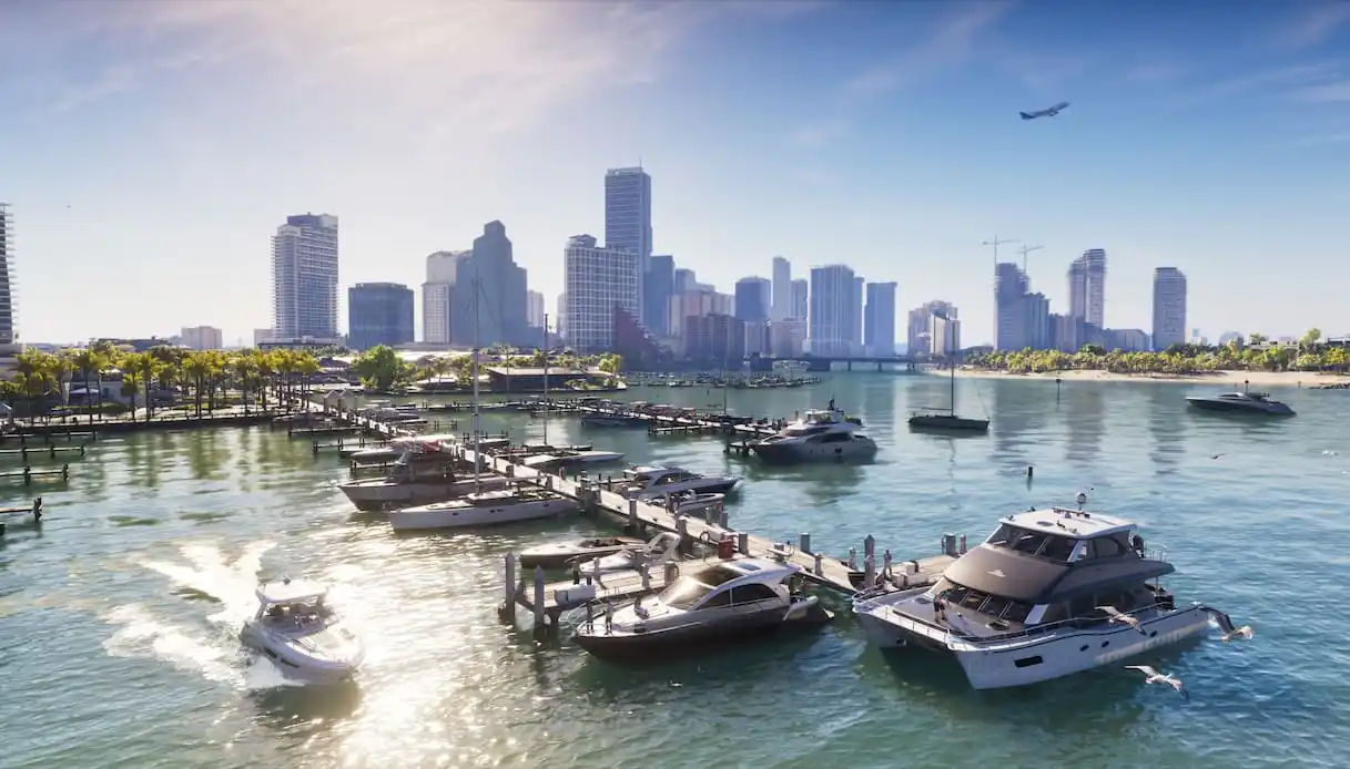
We waited 13 years since the release of GTA V. Some spent that time growing a beard, some have already found the first strands of white in it, and some say they’ll take vacation soon just to play. Destination? Vice City, of course. GTA 6 lands in Italy at midnight between November 18 and 19, 2026 on PlayStation 5 and Xbox Series X|S.
For those truly eager to start, though, the first stop has a precise address: Ocean Drive, Miami Beach. It’s here, among Art Deco hotels and neon signs, that the city Rockstar Games reimagines comes to life. And the journey continues beyond the boardwalk, along the bridges of the Florida Keys and through the marshy expanses of the Everglades. In the game this state is named Leonida and features 6 distinct regions. In reality, to explore it, you just need to hit the road in Florida.
Miami Beach and Ocean Drive, the Heart of Vice City
At sunset, along Ocean Drive, neon signs bathe the façades of Art Deco hotels in pink, blue, and green. We are in South Beach, the southern portion of Miami Beach, on the promenade that Rockstar Games drew inspiration from to recreate Vice City’s coast.
A detail that speaks well of the shift from reality to the game. On Ocean Drive stands the Hotel Victor, designed by architect Lawrence Murray Dixon. In GTA 6 the building becomes Hotel Dixon, a tribute to its designer. To admire the hotel and the other Art Deco façades in person, the best vantage is the sidewalk along Lummus Park, with palms and the Atlantic behind.
Little Havana, Miami’s Cuban Quarter
Behind Vice City’s Little Cuba lies Little Havana, the neighborhood where Cuban-American culture is part of everyday life. The tour begins on Calle Ocho, where you can order a Cuban coffee from a ventanita, a small service window that opens directly onto the sidewalk. Then you proceed to Máximo Gómez Park, which everyone calls Domino Park. Under the awnings, residents have gathered for decades to play dominoes. It’s worth pausing to watch a game and then heading to the nearby Paseo de las Estrellas, with stars dedicated to Latin American artists.
Wynwood, GTA 6 Has Ended Up on the Walls
In Wynwood, the Miami district paired with the game’s Stockyard, street art has transformed the façades of former warehouses and sheds. For the launch, Rockstar Games and Wynwood Walls brought ten murals based on original works created for GTA 6 to the neighborhood. Some are inside the open-air museum, others on the walls of surrounding streets. The stroll can start at NW 2nd Avenue and continue without a fixed route. Here, to find a piece of Vice City, sometimes you just need to turn a corner.
Kaseya Center, Home of the Miami Heat
The Kaseya Center gazes out over Biscayne Bay and serves as the home arena for the Miami Heat. The shape of the arena and its coastal position evoke the Sahara Arena from Vice City. For the game’s launch, a gigantic Welcome to Vice City banner appeared on the roof of the real arena. The waypoint to reach it on foot is Biscayne Boulevard in downtown Miami. From there you can continue toward Bayside Marketplace and Bayfront Park. On a game night, it’s worth seeing how the neighborhood changes in the minutes before tip-off.
PortMiami, Cranes and Cruise Ships
In the Vice City imagery there’s also a Miami built from cranes, terminals, and gigantic ships. The reference is PortMiami, the port on Dodge Island, opposite Downtown’s high-rises. Those starting a cruise from here see the skyline recede as the vessel crosses the bay. For those staying on land, a stroll along the Bayfront Park waterfront gives a sense of how close the port is to the center. It’s a city viewpoint that reads clearly in its proportions: dock a ship and the horizon line changes entirely.
Florida Keys, the Road Along the Sea to Key West
In the Leonida Keys, skyscrapers yield to low-lying islands, small harbors, and roads that seem to float. The real journey follows the Overseas Highway, crossing the Florida Keys all the way to Key West. At Marathon you encounter the Seven Mile Bridge, the stretch where the sea fills the windows on both sides. Beside the modern bridge runs the historic one, partly walkable or bikeable up to Pigeon Key, where railroad workers used to live. In Key West, the loop continues among wooden houses with verandas, the Hemingway House and Museum, and the sunset at Mallory Square.
Everglades, Florida of the Alligators
The wetlands of Grassrivers evoke the Everglades, where water flows slowly through marsh grasses. In the national park, one of the most accessible walks is the Anhinga Trail, starting from the Royal Palm Visitor Center near Homestead. The loop runs roughly 1.2 kilometers round trip, alternating paved sections with wooden boardwalks. Among the reeds you can spot turtles, herons, and alligators. And when an anhinga stops to dry its wings in the sun, you understand why taking it slow here pays off.
Panama City Beach, In the Footsteps of Port Gellhorn
Port Gellhorn carries the vibe of an off-season resort town, with old motels and empty plazas. One working theory ties it to Panama City and Panama City Beach in the northwest of Florida. The resemblance comes from observations of the game’s imagery and still awaits confirmation. To explore this stretch of coast, you can follow Front Beach Road and then spend a few hours at St. Andrews State Park. The park faces both the Gulf and the bay, and, to move toward the dunes and the Shell Island sands, there’s a boat shuttle.
Clewiston and Lake Okeechobee, Ambrosia’s Florida
For Ambrosia, the clue points to a sugar refinery, the Allied Crystal. From there, the theory arises that the game’s landscape calls to Clewiston, on the southwestern shore of Lake Okeechobee, where vast sugarcane fields spread out. This link remains an interpretation, but it suggests a detour that would entirely alter the panorama. From the roads threading through the fields you reach the lake’s edge, in a plain where the horizon stretches far. After the Art Deco hotels, murals, and sea bridges, this is the Florida side most likely to be left off a first itinerary—and that makes the detour worthwhile.
The Suwannee River, In the Footsteps of Mount Kalaga
At the far north of Leonida, distant from Vice City’s neon, Mount Kalaga National Park is the GTA 6 zone where the map fills with forests, canyons, and waterways. Among the real-life landscapes it’s been linked to is the Suwannee River, which runs through Georgia and the north of Florida.
The connection remains speculative, but it offers a concrete waypoint for the journey. Near Live Oak, the Suwannee River State Park sits at the confluence with the Withlacoochee. The Sandhill Trail winds through a pine forest and leads to the old Columbus Cemetery, one of the traces of settlements that cropped up along the river.