
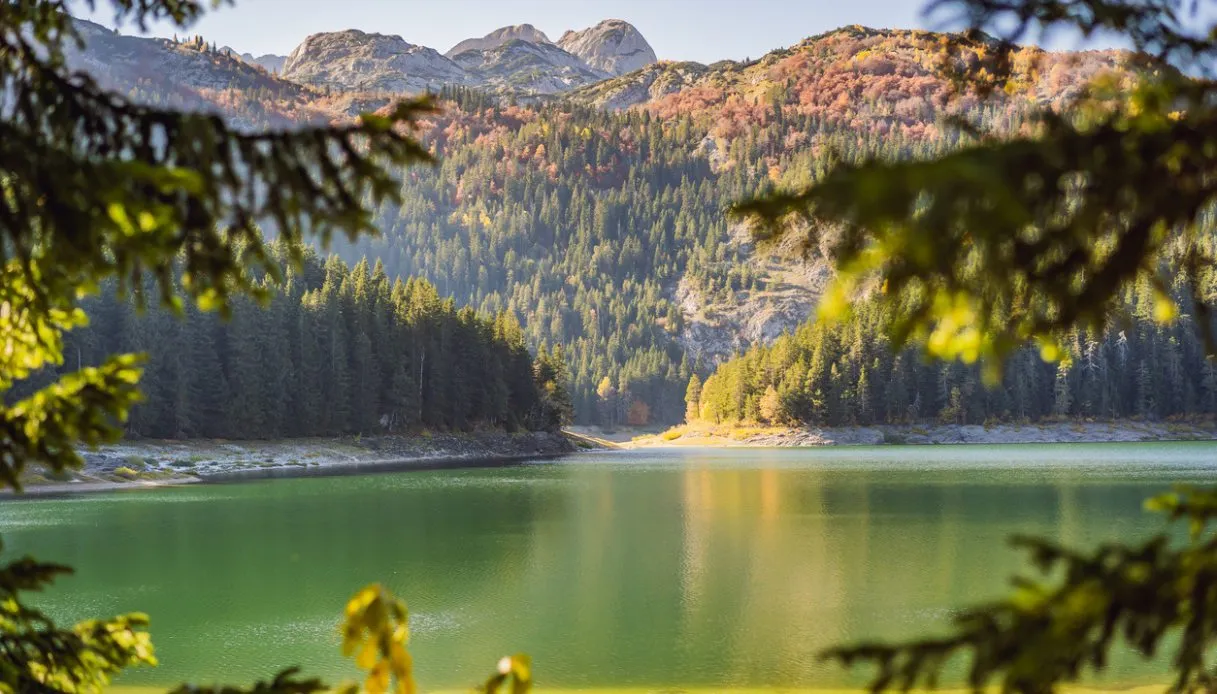
The dark surface of Črno jezero rises among the firs of Pohorje, a large mountainous mass in northeastern Slovenia, and it resembles a pool of ink set into the forest. But the truth is that, beneath that almost-black hue, the water is crystal clear: the effect stems from a particular combination of nature, weather, and history, with a thick layer of organic material deposited on the bottom giving the lake its most enigmatic appearance.
Črno jezero sits at about 1,200 meters above sea level, in a marshy environment dominated by red firs, peat moss, and vegetation typical of the high moors. The damp ground, crossed by wooden walkways, makes the hike different from the usual Alpine itinerary. Underfoot you sense the presence of a delicate ecosystem, while the view shifts from the dark water to the vertical trunks and the quiet clearings.
Origin and Formation of Črno jezero
Despite its wild appearance and its position amid the bog, Črno jezero is a basin of artificial origin. Its basin was dammed about 150 years ago to create a water reservoir useful for transporting timber downstream. The intervention is attributed to the Count Windischgraetz, owner of a substantial portion of the Pohorje forests.
At the time, the mountain’s economy largely revolved around exploiting the woods: logs had to be moved from the forested areas to the valleys and, to facilitate this operation, water was used in the timber transport systems. The dam on the Črnava stream thus transformed a damp depression into a small reservoir intended for practical use.
The current face of the basin, however, is the result of much slower natural processes. On the bottom, for decades, the remains of plants and animals have accumulated, forming a thick layer of dark silt. It is this deposit that gives rise to the black coloration perceived from the shore, even though the water remains particularly clear (especially on bright days).
Črno jezero covers about 50 hectares and is considered the largest lake in the Pohorje. Surrounding it is a tall bog, a moist environment fed mainly by precipitation and characterized by mosses capable of holding large quantities of water. The landscape, therefore, is not merely a forested expanse with a body of water, but a ecological mosaic of particular value.
The entire complex is protected as a nature reserve and natural monument, with particular attention to the bog ecosystem and the fauna that inhabits the wetlands.
Visiting the Lake, the Boardwalk Trail, and What to See
The simplest itinerary begins at the Dom na Osankarici, a shelter located at about 1,192 meters in altitude. From there, the marked path heads west and reaches Črno jezero in roughly 25–30 minutes, at a distance just under 1 kilometer. The route is classified as easy, with a modest elevation gain, and lends itself to a short excursion for those who want to spend only a few hours in this corner of Slovenia.
At the start the trail winds through the forest and passes over sections equipped with wooden steps. Then the ground becomes more humid and the landscape takes on an almost fairy-tale character. The boardwalks overlook the boggy area, allowing one to reach the lake without stepping directly on the waterlogged soil.
The shore is the ideal spot for a pause: some benches let you observe the dark surface and the reflections of the vegetation. In clear weather, the lake reflects the treetops and the sky, creating an almost mirror-like effect. The experience can then continue along the marked paths that connect the lake to other points in the Pohorje.
A possibility leads toward Trije kralji, a location known primarily for hiking and skiing. The route climbs through the forest and passes near the Urška cross before reaching the area of the resort. From there you can reach the Church of the Three Wise Men, a simple exterior building but enriched by three interior altars dedicated to the Three Wise Men, to Saint Francis Xavier and to Saint Lucy.
Another direction leads toward the Šumik waterfall, one of Pohorje’s natural attractions. In this case the activity becomes longer and requires proper planning, especially when the ground is wet or weather conditions are variable.
Near Dom na Osankarici there is also a small museum dedicated to the fallen of the Pohorje Battalion, a partisan formation that fought during World War II. About 30 minutes from the shelter, in the woods, there is the site of the battle at the so-called “Three Nails,” linked to the final clash of the winter of 1943.
For families, the stretch from Osankarica to Črno jezero also includes an educational forest path, with panels and information points dedicated to the flora, fauna, and natural environments of the area.
Location and How to Get There
Črno jezero is located in Pohorje, a wooded massif of northeastern Slovenia, between Osankarica and Veliki vrh, at about 1,200 meters above sea level. The most convenient access point for a short visit is the Dom na Osankarici, reachable by car from several directions. From Maribor you can follow the route toward Hoče and Areh, passing near Ruška koča.
From that point the road continues on a gravel surface and, after about 6 km, you take the marked turn toward Osankarica. The overall journey is nearly 38 km. An alternative from Maribor goes via Selnica ob Dravi, Ruše and Smolnik. In this case the road climbs through the forested landscape and reaches a crossroads near the parking for the Šumik waterfall. By continuing and following the signs, you reach Osankarica after about 5 km. The total distance is roughly 37 km.
From Slovenska Bistrica, the route instead leads toward the Trije kralji complex and then to Dom na Osankarici, for a distance of about 22 km. Another option starts directly from Trije kralji, with a walking itinerary of about 4 km, an estimated duration of 1 hour and with a greater elevation gain than the short access from Osankarica.
For those who wish to reach the lake from Oplotnica, there is also a longer hiking route, indicated at roughly 9.2 km and 3 hours of walking, with a climb of about 954 meters. It is a solution suitable for turning the visit into a true hike through the Pohorje landscape, rather than merely a stroll from the Osankarica facility.
