
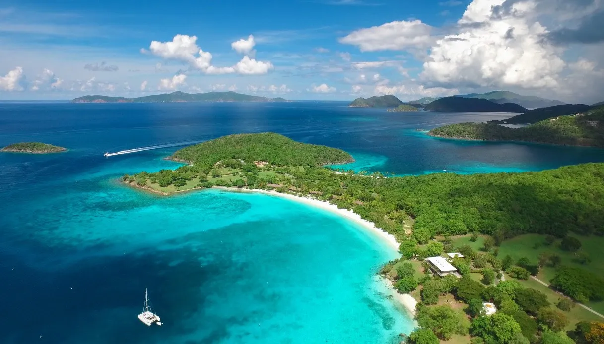
If you’re thinking of the “classic” Caribbean, with wide expanses of sand and palm trees, you’re envisaging a clearly reductive image. Tortola, the largest of the British Virgin Islands, unfolds as a succession of volcanic elevations cloaked in tropical vegetation, secluded coves, small fishing villages, and harbors frequented by sailors from all over the world.
Covering about 55 square kilometers, it was inhabited by Caribbean indigenous peoples before Europeans arrived. It later saw navigator incursions, Dutch presence and English rule, and eventually became “flooded” by sugar cane plantations.
For this reason, it’s not hard at all to encounter abandoned windmills, ancient fortifications and distilleries, but always accompanied by the slow rhythm of the coastal villages animated by soca music and the scent of Caribbean spices that lingers around the street stalls. In the background, of course, a sea capable of moving you.
What to see in Tortola
The beaches are a dream come true, but this jewel of the British Virgin Islands also reveals a dimension tied to Creole culture, seafaring, and the life of rural communities.
Road Town, the harbor-facing capital
The town of Road Town sprawls along the southern coast and is sheltered by hills dotted with colorful houses. Its historic heart is Main Street, lined with colonial-era buildings, shops and small local businesses.
Among the architectural testimonies not to miss are the Anglican church of St. George, the old post office and Old Government House, the residence of the British governors. Also worth noting is the J.R. O’Neal Botanic Gardens, a botanical garden dedicated to tropical flora.
Sage Mountain National Park, the forest on the roof of the Virgin Islands
At about 523 meters above sea level, Mount Sage represents the highest point in the entire Virgin Islands archipelago, including the U.S. ones. Mahogany trees, white cedars, ferns and large boulders accompany trails woven through dense vegetation.
The humidity blown by the trade winds condenses along the slopes, creating favorable conditions for the development of the tropical moist forest. Some paths cross reclaimed old farmland where reforestation has taken place, while gaps between the trees allow glimpses of the sea and the silhouettes of nearby islands.
Ridge Road, the scenic road between two seas
Crossing Tortola along Ridge Road is like unveiling its geography from above: the route follows the central mountain spine, weaving switchbacks, climbs and viewpoints that embrace both sides.
On one side emerge the bays of the northern coast, on the other the Sir Francis Drake Channel, the body of sea that separates Tortola from numerous islands in the archipelago.
Mount Healthy, the windmill that survived the plantations
Mount Healthy Windmill is certainly one of the most significant testimonies to the colonial history of this territory. It was built to grind sugar cane and presents as a circular stone structure with thick walls and arched openings.
It is the last windmill of its kind remaining in the area, standing beside the ruins of the structures used for sugar processing.
Callwood Rum Distillery, the story of Caribbean rum
A few steps from Cane Garden Bay Beach stands a rustic stone building: Callwood Rum Distillery, one of the archipelago’s historic distilleries, also tied to sugar cane processing.
Among old equipment, barrels and straightforward spaces, it still retains that irresistible charm linked to simple architecture, thus far from modern industrial plants.
Fort Burt, the fortifications overlooking Road Harbour
Above Road Town harbor lie the remains of Fort Burt, a fortification rebuilt by the English in 1776 and dedicated to William Burt, a protagonist of the island’s British conquest.
Today there are foundations, traces of ammunition depots and evidence of defensive positions, all located in an area repurposed also for tourist use.
Carrot Bay, Tortola of Traditions
On the northern coast, in Carrot Bay, houses cluster at the foot of the hills, while small boats recall the daily relationship with the sea.
The village is also known for the North Shore Shell Museum, a collection of seashells, artisanal objects and testimonies of local culture.
The beaches of Tortola
Along the northern coastline you can unwind on some of the island’s most evocative bays: exposure to winds and currents significantly alters sea conditions, creating sheltered sands and stretches particularly loved by surfers.
- Smuggler’s Cove: the name evokes the smugglers who once frequented these waters and it is a small bay with crystal-clear water reachable via a dirt road. It is also top-notch for snorkeling.
- Cane Garden Bay: a crescent-shaped sandy bay surrounded by palm trees and green hills, considered among Tortola’s most famous beaches. Restaurants, small venues and boats at anchor give it a lively atmosphere (which becomes even more beautiful at sunset).
- Long Bay Beach: a long stretch of pale sand extending for about 1.5 km at the foot of the hills. The shoreline is especially scenic, particularly when the sun sinks toward the profile of Jost Van Dyke.
- Brewers Bay: nestled between vegetation-covered mountains, it’s ideal for those seeking a more secluded spot. The waters host tropical fish and coral formations, while pelicans can be seen fishing along the shore.
- Apple Bay: one of the places historically frequented by surfers.
- Josiah’s Bay: wide, bright and facing the Atlantic, it has a wilder character, with hills flanking a sandy expanse particularly loved for surfing.
Where it is and how to get there
Tortola is located in the Lesser Antilles, to the east of Puerto Rico and northeast of the U.S. Virgin Islands. It is part of the British Virgin Islands, and from Italy you typically need at least one international layover followed by a regional connection. The main airport is Terrance B. Lettsome International Airport, code EIS, situated on the nearby Beef Island and connected to Tortola via the Queen Elizabeth II Bridge.
Among the possibilities to reach it are routes via San Juan, Puerto Rico, Antigua or Miami, depending on available connections. An alternative is to arrive at Saint Thomas in the U.S. Virgin Islands, followed by a direct ferry to Road Town or West End.
To explore the island, taxis, organized tours and rental cars are available. Traffic drives on the left, in keeping with British tradition, and the mountain roads feature steep grades. The generally most favorable period for a vacation runs from December to April, thus during the relatively drier season.