
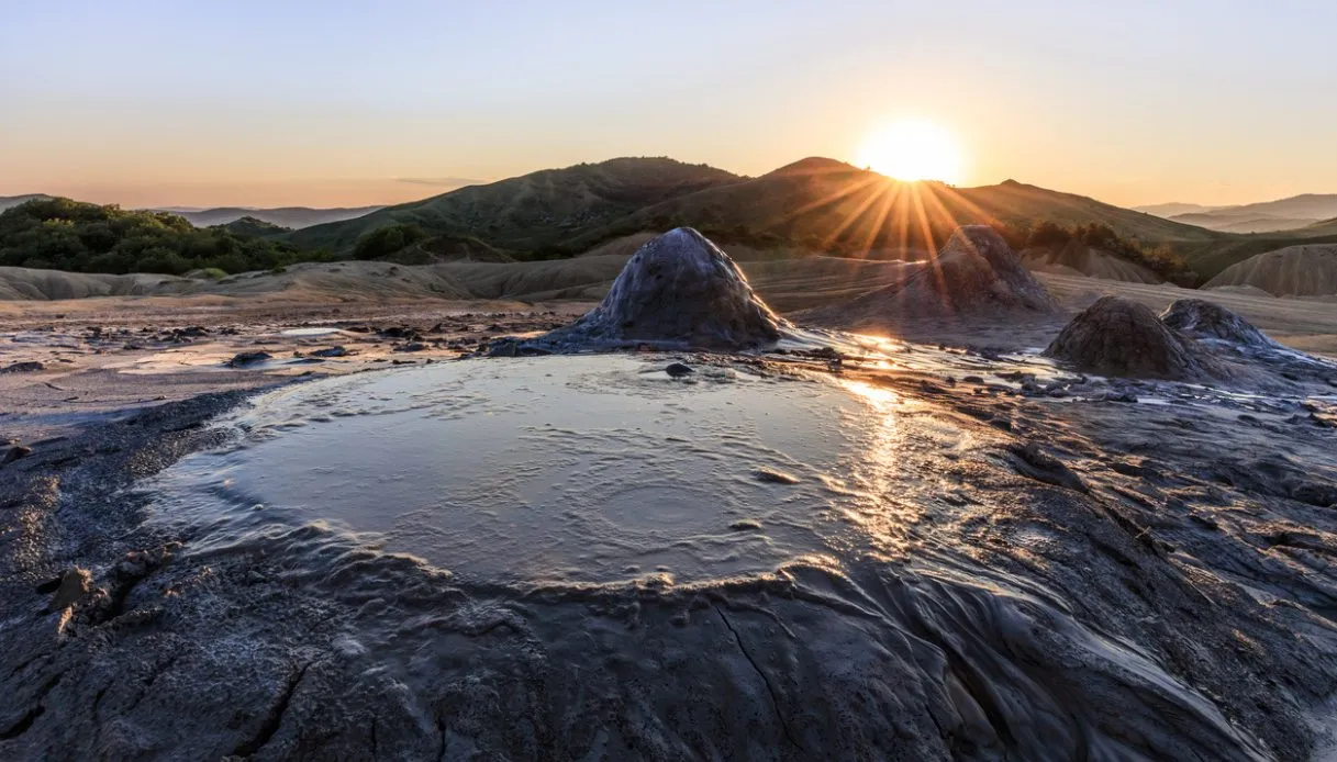
The visitor finds himself facing a gray, cracked ground crossed by thin rivulets of mud that run down along small cones with a surprisingly regular shape. Every now and then he also notices a gurgle, then a bubble slowly swells, bursts and leaves on the surface a circle that fades away within a few seconds. All around, magic happens: green hills and a rural landscape that seems to belong to a completely different world.
Welcome to the mud volcanoes of Berca, known in Romania as Vulcanii Noroioși, one of the most peculiar geological phenomena in Eastern Europe. They are located in Buzău County, in the historic region of Muntenia, at the foot of the Carpathian bend, and have a feature that makes them especially fascinating: they are (small) real volcanoes, but instead of incandescent lava they emit cold mud.
Some of these formations reach several meters in height, others resemble tiny craters just “bloomed” from underground. The vegetation, almost completely absent in the most active areas, accentuates the surreal character of this territory, sometimes nicknamed the Gates of Hell. Since 2022, the volcanoes have been part of the Buzău Land UNESCO Global Geopark, a territory recognized for its extraordinary geological and cultural heritage.
Origin, formation and legends of the Berca mud volcanoes
The subsurface of Buzău is characterized by the presence of hydrocarbons, underground waters and layers of clay-rich rocks. Natural gases (especially methane) rise through fractures and discontinuities in the ground, dragging water and fine sediments. During ascent, these materials mix until they form a dense substance that reaches the surface through small openings.
The pressure triggers the characteristic bubbling, although the mud remains cold. Once expelled it slides along the edges of the crater, accumulates and gradually dries. The subsequent eruptions deposit new layers on the previous ones, contributing to the formation of small conical structures. The activity is continuous but variable, because some mouths exhaust while others open nearby and the flows slowly modify the profile of the clay plains.
Long before scientific explanations, however, the inhabitants of this corner of Romania sought answers in fantastic creatures. According to a local legend, the gray, cracked earth would resemble the skin of a huge dragon hidden in the depths.
The movement of the mud, therefore, would be linked to the presence of the monster that would still live beneath the hills. Another narrative tells of a seven-headed dragon, the story of which is today recalled along the thematic route of Pâclele Mici.
Visiting the mud volcanoes of Berca, what to see among craters and lunar landscapes
The visit is mainly developed between Pâclele Mari and Pâclele Mici, the two most well-known areas of the reserve, which are also connected by a hiking itinerary. The clay plains, almost devoid of vegetation, alternate with grassy slopes, creating a contrast between the green of the hills and the mineral gray of the craters.
Pâclele Mari is located on a dry plateau of about 22 hectares full of conical reliefs, channels cut by the lava flows and vents still active. The site hosts a huge mud structure in the shape of a shield volcano, considered by the geopark the largest mud volcano in Europe. On its surface numerous secondary cones develop, some of which continue to vent clay material.
As you approach, it becomes fairly clear that the dry surfaces display geometric cracks and thin crusts, while the latest flows have a shiny appearance tending toward a metallic sheen. Erosion has also carved deep grooves into the slopes, forming tiny canyons that seem to reproduce (on a reduced scale) the great desert landscapes.
Pâclele Mici, for its part, presents an equally spectacular setting, with numerous openings distributed across an extensive clay surface. The geopark identifies it as the largest field of mud volcanoes in Europe. In the center of the plateau rises a more imposing cone with two large active craters, from which one can observe the irregular rhythm of emissions.
Those who wish to learn about other manifestations of the phenomenon can reach the Beciu area, which is notable especially for the presence of mud pools in constant agitation. The Romanian name Fierbători evokes precisely the impression of a liquid in boiling.
Equally interesting is the botanical component of the reserve: the high saline concentrations strongly limit the growth of common species, but favor some halophilic plants adapted to difficult environmental conditions. Examples include Nitraria schoberi and Atriplex verrucifera, rare species in the Romanian landscape.
Where they are located and how to reach them
The volcanoes are located in Buzău County, in southeastern Romania, about 130 km in a straight line from Bucharest. The main reference city is Buzău itself, from which you reach the area via the national road DN10 toward Brașov. The car represents the most practical solution, given the rural position and the distribution of the different sites.
To explore Pâclele Mari and Pâclele Mici it is advisable to reserve at least 2-3 hours, increasing the time to include Beciu and other attractions of the area. Spring and autumn are generally the most suitable periods, provided the days are dry. It is essential to stay on the permitted routes, avoiding stepping on the fragile rims of the craters or approaching too closely to the pools. Before departure, it is also prudent to check opening hours and access conditions, especially after rainfall.