
Bringing the mountains to the sea, in a sense, is possible. As summer heads toward its last stretch, with milder temperatures and less punishing heat, one of the great pleasures to devote yourself to is trekking. But not with just any excursions; rather, to discover the Italian minor islands, small patches of land, rock, islet, and woods scattered in the vast blue of the Mediterranean.
Italy boasts over 800 islands within its relatively compact territory, of which fewer than a hundred are inhabited. Within this collection lie real treasures of wild nature, spectacular panoramas and crystal-clear seas that have largely remained outside the mass-tourism circuits and have managed to preserve an unchanged and pristine face, to be explored with gentleness and care, step by step.
Alicudi
Fewer than a hundred inhabitants live on Alicudi, the westernmost of the Aeolian Islands. In ancient times this hill that rises abruptly above sea level was known as Ericussa, which in ancient Greek means rich in erica. That herb indeed grows abundantly on the slopes of the Filo dell’Arpa, as the summit that overlooks the island is called.
Almost circular, it is the product of a volcano long extinct for tens of thousands of years. The few residents inhabit the southern side of the island, where narrow plots of land slope as gently as possible toward the sea, in a place that otherwise shows steepness as its defining feature.
From Alicudi Porto unfolds a series of mule tracks that reach the hamlets perched in the mountainous part, characterized by stairs, prickly pears, dry stone walls. Beautiful walks that offer lovely views of the sea and the island’s slopes.
The crown trek is the ascent to the summit of the Filo dell’Arpa: 675 meters above sea level to be climbed in just over two kilometers of steep, rugged path. The view from the top is priceless: it embraces the entire Aeolian archipelago. Those who wish to enjoy a viewpoint overlooking Alicudi’s northwestern area, which is almost inaccessible, can deviate from the path toward the summit, skirting it and reaching the so-called Timpa delle Femmine.
Capraia
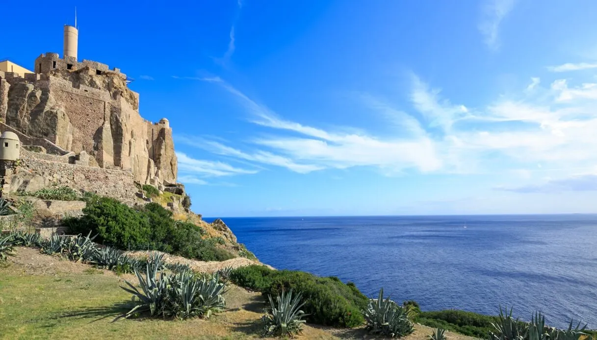
Capraia is one of the lesser-known islands of the Tuscan Archipelago, and perhaps the best suited for hiking enthusiasts. Volcanic, barren, nearly devoid of tall trees, it shows its landscape unfiltered: steep ridges, cliffs over the sea, wide open spaces interrupted by the emergence, near the coastline, of the silhouette of ancient watchtowers, left to guard an horizon that today holds no fear for anyone.
Among the Tuscan islands, it is the farthest from the mainland, and lies closer to Corsica than to Tuscany’s Tyrrhenian coast.
Several hiking trails traverse the island from Capraia Paese to the main ridges and some summits. The quintessential panoramic walk is the one to Monte Castello, the island’s highest point at 445 meters, from which the view spans from Corsica to Elba. It is reached via a trail from the harbor just over five kilometers long.
Those with the legs and time can push on to the Torre dello Zenobito, at the southern end, along a circular route of about 15 kilometers. The tower, built in the sixteenth century by the Genoese who administered the island, overlooks the stunning Cala Rossa, a cliff with a distinctive reddish, iron-rich color, the result of the collapse of a volcanic cone dating back four million years.
Marettimo
Isole Egadi, Sicily. Marettimo is the westernmost of the trio, the one that has best preserved its identity as an island-mountain compared with Favignana and Levanzo, and also the least frequented by tourism, perhaps because it is farther from the mainland, perhaps because it is almost devoid of sandy beaches. A true rock rising in the blue, crisscrossed by a network of sun-drenched trails.
A crucial hub of the island’s trail network are the Roman Houses, remnants of an ancient settlement accompanied by a small church still consecrated. Elevated above the town where ferries bound for Marettimo dock, the Roman Houses already offer a splendid panoramic view.
There are many hikes not to be missed, up and down the ridge that runs north to south across the island. Reaching Pizzo Falcone, Marettimo’s highest peak at 686 meters, means a truly impressive 360-degree panorama, with the possibility to admire the profiles of the other Egadi on the horizon.
The trail to the Castello di Punta Troia, the fortress that the Bourbons used as a prison for political prisoners, is the classic: a mid-slope path that offers breathtaking views of the town and the fortress, perched on a promontory connected to the rest of the island by a narrow strip of land. The fortress, however, preserves a notable historical detail: the great cistern carved into the rock, about 7 meters deep, was transformed into an underground prison with no light, where inmates were lowered from above.
Do not overlook excursions to the western side of the island, where the gaze wanders toward a horizon dominated only by the sea, yet at day’s end offers spellbinding sunsets.
Linosa
It is small, Linosa. Just over five square kilometers in the middle of the Mediterranean, equidistant from the coast of Tunisia to the west and from the coast of Sicily to the north. Its volcanic nature is plainly evident, with its black rocks and conical elevations. Small colorful houses provide a contrast to the rugged nature, completing the panorama.
The classic path climbs to Monte Vulcano, the island’s highest point at a mere 195 meters but with a panorama disproportionate to its height: on days of southwest wind you can even glimpse Lampedusa, which lies more than forty kilometers away.
The other two volcanic elevations, Monte Rosso and Monte Nero, complete the picture of the climbs to be tackled. Both borrow their names from the striking characteristic of their respective terrain: red, iron-rich soil accompanies the ascent to the 187 meters of Monte Rosso, while Monte Nero is made of the typical volcanic rock and overlooks the sea, its crater partially collapsed beneath the level of the swells.
Montecristo
Montecristo is a special case. Not so much because of Dumas’s novel, indeed, but because it is the most inaccessible island in the Tuscan Archipelago. In fact, it has been an Integral State Nature Reserve since 1971 and a Biogenetic Nature Reserve of the Council of Europe. For this reason, the island is not reached by regular transport services and access is allowed exclusively through guided visits authorized by the Carabinieri Biodiversity Department and the National Park of the Tuscan Archipelago.
The number of visitors is thus strictly limited (there are fewer than two thousand spots per year), with reservations to be made well in advance. Once you obtain a place on a guided tour, however, the spectacle is truly formidable.
You land at Cala Maestra, the island’s only permitted landing point, a vast expanse of white sand washed by crystal-clear, Caribbean-like waters. On the island rise a regal nineteenth-century villa, an ancient monastery, and a small natural history museum. The island is rugged and green, with flora shaped by the presence of a population of wild goats, the only such population in Italy. During the visit, you follow one of three didactic itineraries, guided by forest staff and with different levels of difficulty. A fourth route, opened exceptionally and reserved for experienced hikers, leads to the summit of Monte della Fortezza, the highest feature on Montecristo, above 600 meters in altitude.
Palmaria
Palmaria is the largest island of Liguria, even though its total area is a mere 1.89 square kilometers. It lies opposite Portovenere, separated from the mainland by just a few hundred meters of sea. It forms, together with Portovenere, the Cinque Terre and the nearby islands of Tino and Tinetto, part of the UNESCO site of the Gulf of Poets. Undertaking its circuit on foot is one of the region’s most beloved hikes.
The circular path, marked as 510, starts from the Terrizzo landing and unfolds for about six kilometers, touching Forte Umberto I, the so-called Pozzale at the island’s southernmost tip, and Punta Carlo Alberto. The total elevation gain is around 450 meters, with the steepest climb reaching up to Punta Carlo Alberto, from which a beautiful panorama of Portovenere and, in particular, the Church of San Pietro can be admired. The hike takes around three hours.
Along the route, on Palmaria’s southern tip, one also encounters the remains of a black marble quarry, once among the region’s most prized materials.
